Category:Maps of the Gilbert Islands
Jump to navigation
Jump to search
Media in category "Maps of the Gilbert Islands"
The following 56 files are in this category, out of 56 total.
-
00-250 Tabiteuea.png 1,892 × 2,043; 335 KB
-
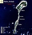
01 Map of Makin, Kiribati.jpg 468 × 501; 57 KB
-
02 Map of Butaritari, Kiribati.jpg 1,031 × 713; 186 KB
-
04 Map of Abaiang, Kiribati.jpg 768 × 994; 149 KB
-
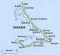
06 Map of South Tarawa, Kiribati.jpg 1,294 × 509; 106 KB
-
10 Map of Aranuka, Kiribati.jpg 768 × 798; 63 KB
-
11 Map of Nonouti, Kiribati.jpg 768 × 805; 61 KB
-
12 Map of Tabiteuea North, Kiribati.jpg 768 × 1,006; 49 KB
-
13 Map of Tabiteuea South, Kiribati.jpg 740 × 1,024; 69 KB
-
14 Map of Beru, Kiribati.jpg 768 × 914; 87 KB
-
15 Map of Nikunau, Kiribati.jpg 768 × 823; 69 KB
-
16 Map of Onotoa, Kiribati.jpg 768 × 973; 81 KB
-
17 Map of Tamana, Kiribati.jpg 768 × 879; 383 KB
-
18 Map of Arorae, Kiribati.jpg 768 × 841; 62 KB
-
3 Map of Marakei, Kiribati.jpg 725 × 1,024; 163 KB
-
5 Map of North Tarawa, Kiribati.jpg 853 × 768; 55 KB
-
7 Map of Maiana, Kiribati.jpg 777 × 873; 229 KB
-
8 Map of Abemama, Kiribati.jpg 600 × 776; 239 KB
-
9 Map of Kuria, Kiribati.jpg 816 × 839; 140 KB
-
Abaiang 1873 map.jpg 4,297 × 2,957; 5.66 MB
-
Abaiang-Tarawa 1873 map nla obj-233983677-1 (retouched).jpg 5,000 × 7,379; 14.3 MB
-
Abaiang-Tarawa 1873 map nla.obj-233983677-1.jpg 5,000 × 7,379; 12.38 MB
-
Abemama Map.jpg 5,310 × 5,667; 1.32 MB
-
Arorae carte.png 535 × 508; 18 KB
-
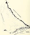
Atoll research bulletin (1952) (20346076255).jpg 2,194 × 3,036; 1.3 MB
-
Atoll research bulletin (1956) (20158103080).jpg 1,756 × 3,284; 864 KB
-
Battle of Makin map.jpg 639 × 544; 29 KB
-
Butaritari Map.jpg 7,864 × 6,982; 1.32 MB
-
FMIB 53006 Gilbert or Kingsmill Islands.jpeg 490 × 758; 56 KB
-
Gilbert Islands map.png 1,400 × 1,100; 66 KB
-
GilbertIslandsPos.png 2,371 × 1,804; 1,000 KB
-
KAPII Outer Islands.jpg 1,654 × 2,339; 523 KB
-
KAPII Tarawa.jpg 1,654 × 2,339; 545 KB
-
KI Gilbert islands mk.PNG 500 × 500; 27 KB
-
KI Gilbert islands.PNG 500 × 500; 9 KB
-
Kiribati Gilbert Islands location map.svg 638 × 560; 41 KB
-
Makin-map.png 1,142 × 1,902; 59 KB
-
Nikunau tamana gilbert islands.jpg 641 × 575; 109 KB
-
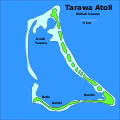
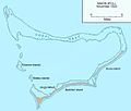
South Tarawa (map within Tarawa Atoll).png 600 × 600; 62 KB
-
South Tarawa (north and south labeled).svg 694 × 694; 39 KB
-
South Tarawa (separated to north and south) - bel.svg 694 × 694; 31 KB
-
South Tarawa (separated to north and south).svg 694 × 694; 35 KB
-
Tamana Island mk.svg 984 × 540; 21 KB
-
Tamana Island.svg 984 × 540; 21 KB
-
USMC-M-Tarawa-11.jpg 1,000 × 1,087; 107 KB
-
USMC-M-Tarawa-3.jpg 800 × 602; 77 KB
-
Tarawa 1873 map.jpg 4,277 × 3,473; 5.41 MB
-
Tarawa 1951 map 20157364658 d8596088db o.jpg 2,242 × 2,554; 588 KB
-
Tarawa Atoll, Kiribati mk.svg 694 × 694; 30 KB
-
Tarawa Atoll, Kiribati.svg 694 × 694; 25 KB
-
Tarawa Island.jpg 353 × 464; 43 KB
-
Tarawa map w.jpg 409 × 371; 12 KB
-
Tarawa Map.jpg 6,174 × 6,826; 1.3 MB
-
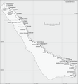
Tarawa-old.jpg 643 × 794; 119 KB
-
Карта атолла Абаианг.PNG 1,032 × 794; 58 KB


.jpg/120px-607_of_%27Unser_Wissen_von_der_Erde._Allgemeine_Erdkunde_und_Länderkunde%2C_herausgegeben_unter_fachmännischer_Mitwirkung_von_A._Kirchhoff%27_(11287865676).jpg)


.jpg/81px-Abaiang-Tarawa_1873_map_nla_obj-233983677-1_(retouched).jpg)


_(20346076255).jpg/87px-Atoll_research_bulletin_(1952)_(20346076255).jpg)
_(20158103080).jpg/64px-Atoll_research_bulletin_(1956)_(20158103080).jpg)


.png/120px-South_Tarawa_(map_within_Tarawa_Atoll).png)
.svg/120px-South_Tarawa_(north_and_south_labeled).svg.png)
_-_bel.svg/120px-South_Tarawa_(separated_to_north_and_south)_-_bel.svg.png)
.svg/120px-South_Tarawa_(separated_to_north_and_south).svg.png)


